
Photo Agency - Astronomy - Space - Nature


> Finland seen from satellite Envisat
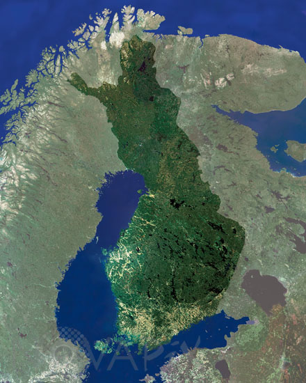
Finland seen from satellite Envisat
author: Esa/Novapix
reference: t-eufin-00001
Image Size 300 DPI: 38 * 48 cm
This MERIS (MEdium Resolution Imaging Spectrometer) image centres over Finland. Nearly a third of the country lies above the Arctic Circle and the country has over 60,000 lakes. Projecting eastwards into the Baltic Sea is the Ahvenanmaa Archipelago (Aland Islands), which consists of over 6,500 islands. The capital and largest city is Helsinki.
Keywords for this photo:
EARTH - EARTH FROM SPACE - ENVISAT - EUROPE - FINLAND - MERIS - SATELLITE IMAGE - SEA -
Contact : Stéphane Aubin +33-(0)9-51-26-53-76
© Novapix - All rights reserved