
Photo Agency - Astronomy - Space - Nature


> Hungary seen from satellite Envisat
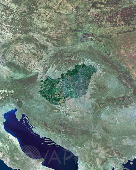
Hungary seen from satellite Envisat
author: Esa/Novapix
reference: t-euhon-00001
Image Size 300 DPI: 38 * 48 cm
This mosaic image focuses on Hungary. Hungary consist of two main regions, a plain around the Danube River in the eastern part of the country, and highlands and mountains that are part of the Carpathian Mountain chain, towards the north.
Keywords for this photo:
EARTH - EARTH FROM SPACE - ENVISAT - EUROPE - HUNGARY - MERIS - SATELLITE IMAGE -
Contact : Stéphane Aubin +33-(0)9-51-26-53-76
© Novapix - All rights reserved