 t-nacal-00003
← Collection
images
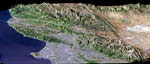
Los Angeles and the San Andreas fault
- Reference
- t-nacal-00003
- Date
- 2007-03-06
Perspective view of Los Angeles, San Gabriel Mountains and Mojave Desert. The San Andreas fault divides the region in forming a straight topographical boundary between the top center and lower right corner of the image.Landsat-7 picture acquired on May 4 2001 combined with a radar image from SRTM, on board the space shuttle Endeavour on February 11 2000.
Contact →