 t-eumal-00002
← Collection
images
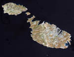
Malta seen from satellite
- Reference
- t-eumal-00002
- Date
- 2008-06-12
Malta, an independent republic, consists of a small group of islands located in the Mediterranean Sea south of Sicily, with a total area of 316 square kilometers. The capital and leading port of the country is Valletta, which appears as a gray patch around the two deep inlets on Malta's northern coastline. This natural-color image was acquired on July 29, 2001, by the Advanced Spaceborne Thermal Emission and Reflection Radiometer (ASTER) aboard NASA's Terra satellite.
Contact →