Photo Agency - Astronomy - Space - Nature

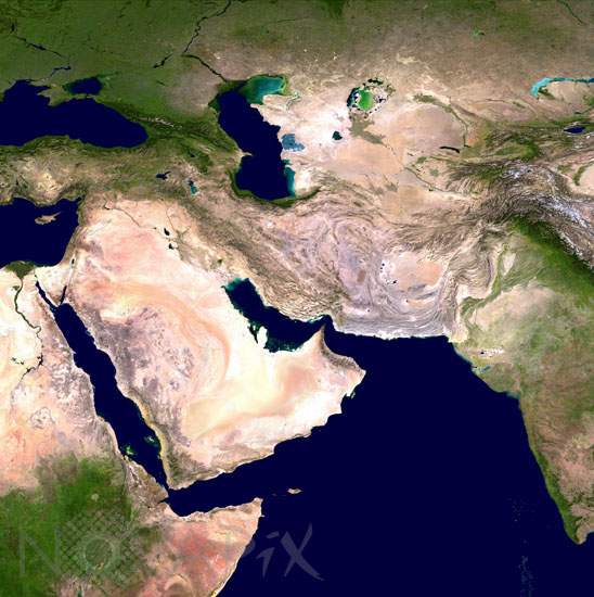
Western Asia seen by satellite
author: Nasa/Usgs/Novapix
reference: t-as000-00001
Image Size 300 DPI: 61 * 61 cm
Western Asia, the world’s largest continent, occupies one-third of the Earth’s landmass. Although divisions are somewhat arbitrary, Western Asia encompasses the Middle East and countries that surround the Caspian Sea, including Kazakhstan and Russia.
Keywords for this photo:
AFGHANISTAN - ARAL SEA - ASIA - CASPIAN SEA - CYPRUS - EARTH - EARTH FROM SPACE - IRAN - IRAQ - ISRAEL - KAZAKHSTAN - KUWAIT - KYRGYZSTAN - LEBANON - MIDDLE EAST - OMAN - PAKISTAN - POSTER - QATAR - RED SEA - SATELLITE IMAGE - SAUDI ARABIA - SEA - TAJIKISTAN - TURKMENISTAN - UNITED ARAB EMIRATES - UZBEKISTAN - YEMEN -
Contact : Stéphane Aubin +33-(0)9-51-26-53-76
© Novapix - All rights reserved


