Photo Agency - Astronomy - Space - Nature

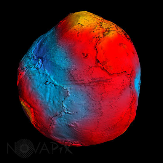
Earth's geoid
author: ESA/HPF/DLR/Novapix
reference: t-glb05-00185
Image Size 300 DPI: 25 * 25 cm
ESA's GOCE mission has delivered the most accurate model of the 'geoid' ever produced, which will be used to further our understanding of how Earth works.
A precise model of Earth's geoid is crucial for deriving accurate measurements of ocean circulation, sea-level change and terrestrial ice dynamics. The geoid is also used as a reference surface from which to map the topographical features on the planet. In addition, a better understanding of variations in the gravity field will lead to a deeper understanding of Earth's interior, such as the physics and dynamics associated with volcanic activity and earthquakes.
Keywords for this photo:
2011 - EARTH - EARTH FROM SPACE - FALSE COLOR - GEOID - GLOBAL VIEW - GOCE - GRAVITY - OCEAN - PLANET - SATELLITE IMAGE -
Contact : Stéphane Aubin +33-(0)9-51-26-53-76
© Novapix - All rights reserved


