Photo Agency - Astronomy - Space - Nature

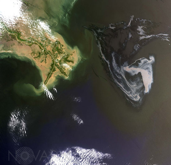
Gulf of Mexico oil spill
author: USGS/Novapix
reference: t-nalou-00007
Image Size 300 DPI: 21 * 20 cm
On April 20, 2010, the oil rig Deepwater Horizon suffered an explosion and sank two days later. Shortly thereafter, oil began leaking into the Gulf of Mexico from ruptured pipes deep on the ocean floor. Landsat-7 image of the oil spill (on the right) in the Gulf of Mexico. The image was acquired on 1st May 2010.
Contact : Stéphane Aubin +33-(0)9-51-26-53-76
© Novapix - All rights reserved


