
Photo Agency - Astronomy - Space - Nature


> The Galapagos Islands seen by satellite
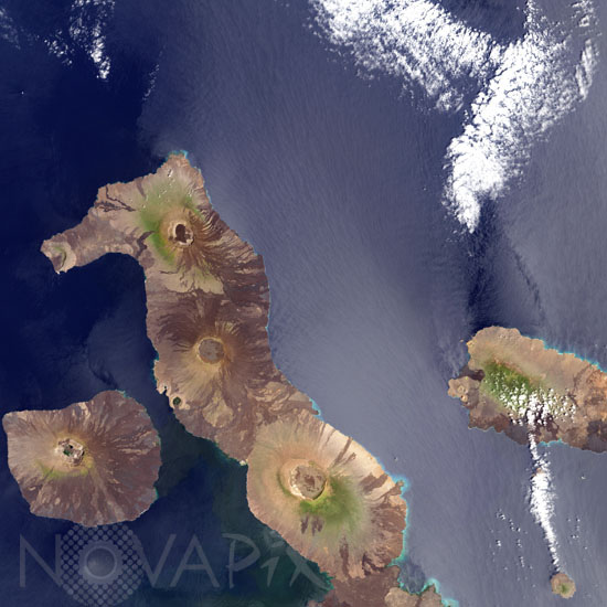
The Galapagos Islands seen by satellite
author: Nasa/Novapix
reference: t-sagpg-00002
Image Size 300 DPI: 33 * 33 cm
North of the Galapagosâ largest island, Isabela, where several volcanos appear. From the top to bottom are volcano Wolf, ranking among the archipelagoâs most active volcanoes, Darwin and Alcedo.
To the left of Isabela is Fernandina island, at right is Santiago island. NASAâs Landsat 7 satellite captured this true-color image on October 16, 2001.
Contact : Stéphane Aubin +33-(0)9-51-26-53-76
© Novapix - All rights reserved