
Photo Agency - Astronomy - Space - Nature


> Pingualuit crater seen by satellite
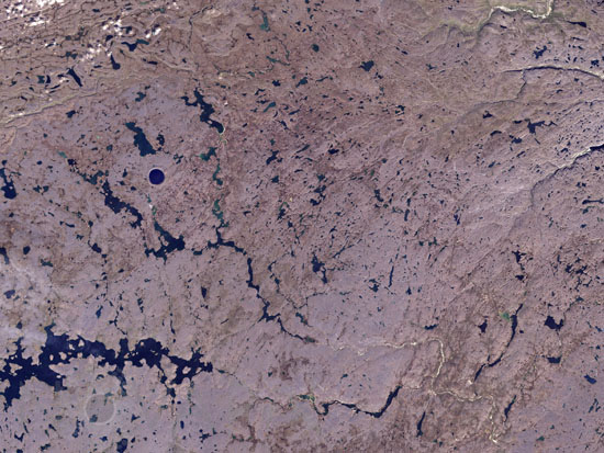
Pingualuit crater seen by satellite
author: Nasa/Novapix
reference: t-cra06-00200
Image Size 300 DPI: 33 * 25 cm
NASAâs Landsat 7 satellite captured this image of Pingualuit Crater (a meteorite crater produced from an impact roughly 1.4 million years ago) on August 17, 2002. In this image, water appears blue, and land appears in varying shades of beige. The high latitude of the area limits vegetation, so thick, lush forests do not flourish in this region. With a diameter of 3.44 kilometers (2.14 miles), Pingualuit Crater holds a lake about 267 meters (876 feet) deep. The crater is the blue circle visible in the left part of the image
Keywords for this photo:
2002 - CANADA - EARTH - EARTH FROM SPACE - IMPACT - IMPACT CRATER - LANDSAT - LANDSAT-7 - QUEBEC - SATELLITE IMAGE -
Contact : Stéphane Aubin +33-(0)9-51-26-53-76
© Novapix - All rights reserved