
Photo Agency - Astronomy - Space - Nature


> 2016: the second lowest Arctic sea ice minimum
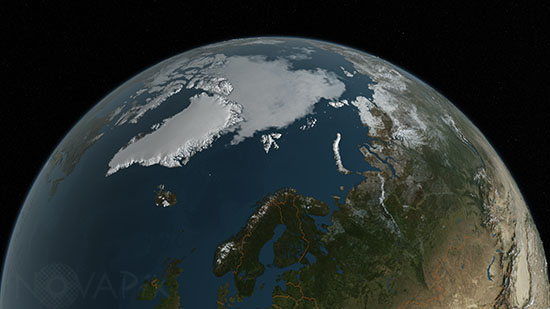
2016: the second lowest Arctic sea ice minimum
author: Nasa/GSFC/Novapix
reference: t-arc01-00020
Image Size 300 DPI: 32 * 18 cm
On September 10, Arctic sea ice extent stood at 4.14 million square kilometers (1.60 million square miles). This appears to have been the lowest extent of the year and is tied with 2007 as the second lowest extent on record. This yearâs minimum extent is 750,000 square kilometers (290,000 square miles) above the record low set in 2012 and is well below the two standard deviation range for the 37-year satellite record. Satellite data show extensive areas of open water in the Beaufort and Chukchi seas, and in the Laptev and East Siberian seas.
Contact : Stéphane Aubin +33-(0)9-51-26-53-76
© Novapix - All rights reserved