
Photo Agency - Astronomy - Space - Nature


> Athabasca Oil Sands - Canada
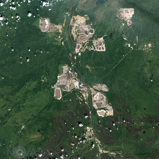
Athabasca Oil Sands - Canada
author: Nasa/Novapix
reference: t-nacan-00014
Image Size 300 DPI: 27 * 27 cm
Landsat-8 satellite image of surface mines over the Athabasca oil sands in 2016. The Athabasca River runs through the center of the scene, separating two major operations. To extract the oil at these locations, oil producers remove the sand in big, open-pit mines, which are tan and irregularly shaped. The sand is rinsed with hot water to separate the oil, and then the sand and wastewater are stored in âtailings ponds,â which have smooth tan or green surfaces in this satellite image. At the bottom of the image is the city of Fort McMurray.
Keywords for this photo:
2016 - ALBERTA - ATHABASCA - CANADA - EARTH - EARTH FROM SPACE - FOREST - LANDSAT - LANDSAT-8 - MINE - OIL - POLLUTION - SAND - SATELLITE IMAGE -
Contact : Stéphane Aubin +33-(0)9-51-26-53-76
© Novapix - All rights reserved