
Photo Agency - Astronomy - Space - Nature


> Tokyo and area, Japan. Satellite image.
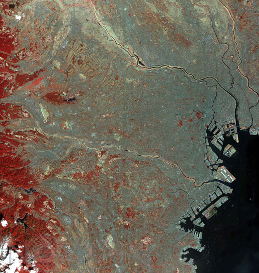
Tokyo and area, Japan. Satellite image.
author: Nasa/Novapix
reference: t-asjap-00003
Image Size 300 DPI: 34 * 36 cm
This image of the city of Tokyo was acquired on March 22, 2000; it covers an area 60 km (37 miles) wide and 75 km (47 miles) long. The image displays three bands of the reflected visible and infrared wavelength region, with a spatial resolution of 15 m. It shows part of the Tokyo metropolitan area extending south to Yokohama. Included are the Ginza District, Haneda Airport and the Imperial Palace. To the west, Tokyo is hemmed in by mountains, covered with forests (displayed in red); on the southeast, Tokyo Bay is one of the world's great harbors.
Keywords for this photo:
AIRPORT - ASIA - ASTER - BAY - CAPITAL - CITY - EARTH - EARTH FROM SPACE - FALSE COLOR - HARBOR - INFRARED - JAPAN - SATELLITE IMAGE - TERRA - TOKYO -
Contact : Stéphane Aubin +33-(0)9-51-26-53-76
© Novapix - All rights reserved