
Photo Agency - Astronomy - Space - Nature


> Pakistan, Indus river seen from space.
Pakistan, Indus river seen from space.
author: Nasa/Novapix
reference: t-aspak-00001
Image Size 300 DPI: 33 * 34 cm
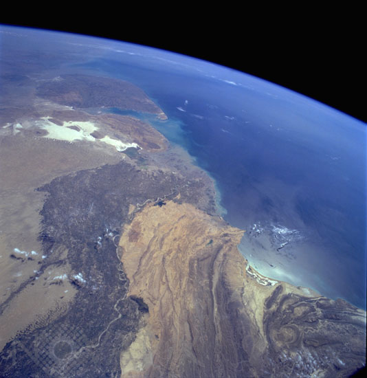
Two major physiographic features appear in this south-southeast-looking, high-oblique photograph of southern Pakistan"the Indus River and its floodplain and the southeastern end of the complex Makran Mountain Range. The Indus River and its highly cultivated floodplain produce a variety of grain crops and cotton. The dark Indus River floodplain is bordered on the east by the Thar Desert (Great Indian Desert) and the highly reflective (white) area in India known as the Great Rann of Kutch (large salt marsh); on the west it is bordered by the complex, folded Makran Mountain Range. Karachi (with an estimated 1990 population of almost 10 million), the major port city on the Arabian Sea and former capital, is located along the western edge of the Indus River floodplain. The large peninsula southeast of the mouths of the Indus River is the Kathiawar Peninsula of India, the home of the only remaining Asian lions.Ilake taken from the space shuttle Columbia in March 1994.
Contact : Stéphane Aubin +33-(0)9-51-26-53-76
© Novapix - All rights reserved