
Photo Agency - Astronomy - Space - Nature


> Volga river seen from satellite.
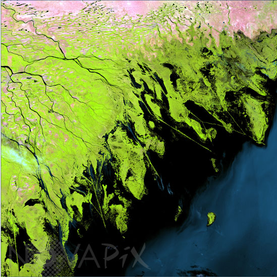
Volga river seen from satellite.
author: USGS/Novapix
reference: t-asrus-00002
Image Size 300 DPI: 26 * 26 cm
Where the Volga River flows into the Caspian Sea, it creates an extensive delta. The Volga Delta is comprised of more than 500 channels, and sustains the most productive fishing grounds in Eurasia. Satellite image from Landsat-7, August 29 1999.
Keywords for this photo:
1999 - ASIA - CASPIAN SEA - DELTA - EARTH - EARTH FROM SPACE - FALSE COLOR - LANDSAT - LANDSAT-7 - RIVER - RUSSIA - SATELLITE IMAGE - SEA - VOLGA - VOLGA RIVER - WATER -
Contact : Stéphane Aubin +33-(0)9-51-26-53-76
© Novapix - All rights reserved