
Photo Agency - Astronomy - Space - Nature


> Richat structure, Mauritania, seen by Landsat-7 satellite
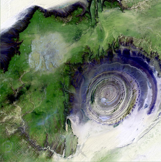
Richat structure, Mauritania, seen by Landsat-7 satellite
author: USGS/Novapix
reference: t-afmau-00001
Image Size 300 DPI: 26 * 26 cm
The so-called Richat Structure is a geological formation in the Maur Adrar Desert in the African country of Mauritania. Although it resembles an impact crater, the Richat Structure formed when a volcanic dome hardened and gradually eroded, exposing the onion-like layers of rock. Jan 11 2001.
Keywords for this photo:
2001 - AFRICA - DESERT - EARTH - EARTH FROM SPACE - FALSE COLOR - LANDSAT - LANDSAT-7 - MAURITANIA - RICHAT - SATELLITE IMAGE - VOLCANO -
Contact : Stéphane Aubin +33-(0)9-51-26-53-76
© Novapix - All rights reserved