
Photo Agency - Astronomy - Space - Nature


> Earth by satellite
Earth by satellite
author: Nasa/ESA/Novapix
reference: t-glb05-00100
Image Size 300 DPI: 34 * 36 cm
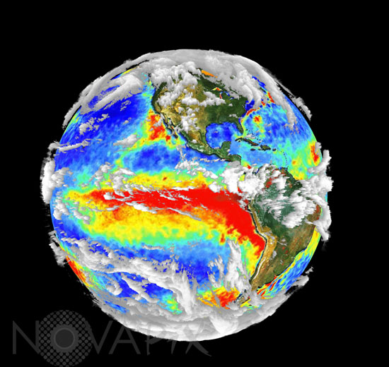
This globe shows data collected from multiple sensors aboard NASA's Terra spacecraft and integrated into one image. Notice the three-dimensional cloud measurements. The 1997-98 El Nino temperature anomaly is visible as red in the Pacific Ocean while the red dots on land show the locations of forest fires.
Keywords for this photo:
3D - CLOUD - EARTH - EARTH FROM SPACE - EL NINO - FIRE - GLOBAL VIEW - METEOROLOGY - MODIS - OCEAN - PACIFIC OCEAN - PLANET - SATELLITE IMAGE - TEMPERATURE - TERRA -
Contact : Stéphane Aubin +33-(0)9-51-26-53-76
© Novapix - All rights reserved