
Photo Agency - Astronomy - Space - Nature


> Earth by satellite
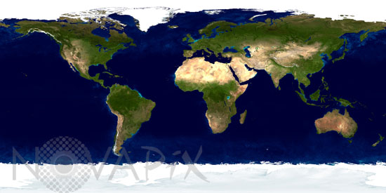
Earth by satellite
author: Nasa/GSFC/Novapix
reference: t-glb50-00001
Image Size 300 DPI: 69 * 34 cm
Flying over 700 km above the Earth onboard the Terra satellite, MODIS provides an integrated tool for observing a variety of terrestrial, oceanic, and atmospheric features of the Earth. The land and coastal ocean portions of these images are based on surface observations collected from June through September 2001 and combined, or composited, every eight days to compensate for clouds that might block the sensor's view of the surface on any single day.
Keywords for this photo:
CONTINENT - EARTH - EARTH FROM SPACE - GLOBAL VIEW - MODIS - PLANET - PLANISPHERE - POSTER - SATELLITE IMAGE - TERRA -
Contact : Stéphane Aubin +33-(0)9-51-26-53-76
© Novapix - All rights reserved