
Photo Agency - Astronomy - Space - Nature


> North Pole by satellite 09/2005
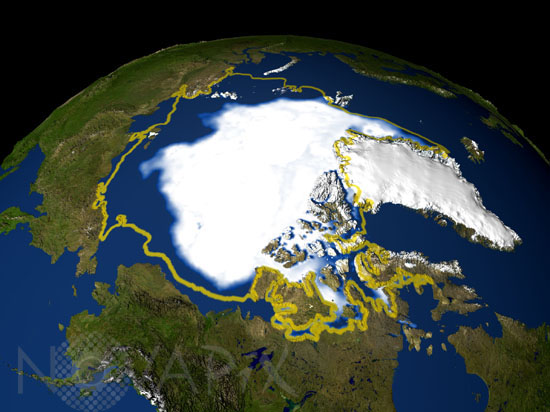
North Pole by satellite 09/2005
author: Nasa/GSFC/Novapix
reference: t-arc01-00007
Image Size 300 DPI: 21 * 16 cm
The minimum concentration of Arctic sea ice in 2005 occurred on September 21, 2005, when the sea ice extent dropped to 2.05 million sq. miles, the lowest extent yet recorded in the satellite record. The yellow line represents the average location of the ice edge of the perennial sea ice cover for the years 1979 through 2005.
Contact : Stéphane Aubin +33-(0)9-51-26-53-76
© Novapix - All rights reserved