
Photo Agency - Astronomy - Space - Nature


> Eastern Africa by Terra satellite
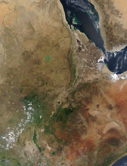
Eastern Africa by Terra satellite
author: Nasa/GSFC/Novapix
reference: t-afeth-00003
Image Size 300 DPI: 49 * 64 cm
View of the eastern area of Africa showing the Afar depression, the junction of three tectonic plates.
Most of the image shows Ethiopia crossed by the Rift.
Image taken in January 2003, captured by the MODIS instrument on the Terra satellite.
NB : border lines are marked
Most of the image shows Ethiopia crossed by the Rift.
Image taken in January 2003, captured by the MODIS instrument on the Terra satellite.
NB : border lines are marked
Contact : Stéphane Aubin +33-(0)9-51-26-53-76
© Novapix - All rights reserved