
Photo Agency - Astronomy - Space - Nature


> Changes in the elevation over the Greenland ice sheet
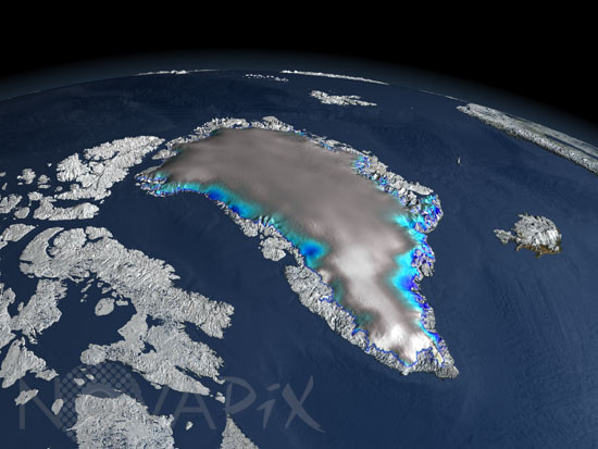
Changes in the elevation over the Greenland ice sheet
author: Nasa/GSFC/Novapix
reference: t-eugro-00004
Image Size 300 DPI: 33 * 25 cm
Since its launch in January 2003, the ICESat elevation satellite has been measuring the change in thickness of the ice sheets. This image of Greenland shows the changes in elevation over the Greenland ice sheet between 2003 and 2006, The white regions indicate a slight thickening, while the blue shades indicate a thinning of the ice sheet. Gray indicates areas where no change in elevation was measured.
Contact : Stéphane Aubin +33-(0)9-51-26-53-76
© Novapix - All rights reserved