
Photo Agency - Astronomy - Space - Nature


> Cyprus seen from satellite Envisat
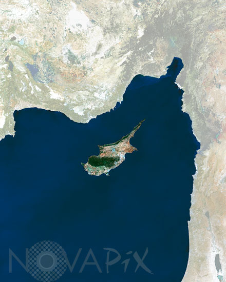
Cyprus seen from satellite Envisat
author: Esa/Novapix
reference: t-euchy-00001
Image Size 300 DPI: 21 * 26 cm
This MERIS (MEdium Resolution Imaging Spectrometer) image focuses on the eastern Mediterranean island of Cyprus.
Nicosia, the capital and largest city, is situated towards the centre of the island.
The green area in the southern central part of the island is the slopes of the Troodos Mountains, the highest point of which is Mt. Olympus (1951 m).
Nicosia, the capital and largest city, is situated towards the centre of the island.
The green area in the southern central part of the island is the slopes of the Troodos Mountains, the highest point of which is Mt. Olympus (1951 m).
Keywords for this photo:
CYPRUS - EARTH - EARTH FROM SPACE - ENVISAT - EUROPE - ISLAND - MEDITERRANEAN SEA - MERIS - SATELLITE IMAGE -
Contact : Stéphane Aubin +33-(0)9-51-26-53-76
© Novapix - All rights reserved