
Photo Agency - Astronomy - Space - Nature


> Malta seen from satellite Envisat
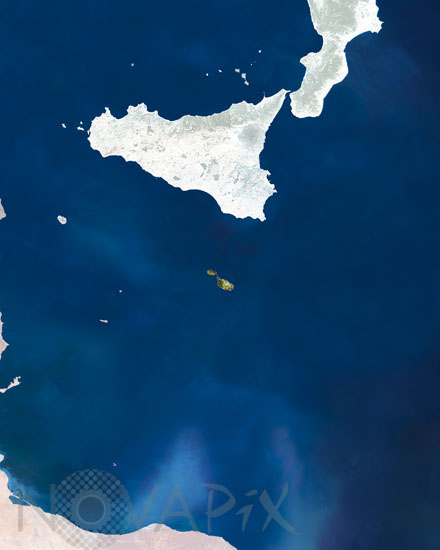
Malta seen from satellite Envisat
author: Esa/Novapix
reference: t-eumal-00001
Image Size 300 DPI: 21 * 26 cm
This MERIS (MEdium Resolution Imaging Spectrometer) image is centred over the island of Malta (dark green area). It is located some 93 km south of Sicily, in the central Mediterranean Sea. It consists of an archipelago but only the three largest islands: Malta Island, Gozo, and Comino are inhabited.
Keywords for this photo:
EARTH - EARTH FROM SPACE - ENVISAT - EUROPE - ISLAND - MALTA - MEDITERRANEAN SEA - MERIS - SATELLITE IMAGE -
Contact : Stéphane Aubin +33-(0)9-51-26-53-76
© Novapix - All rights reserved