
Photo Agency - Astronomy - Space - Nature


> Malta seen from satellite
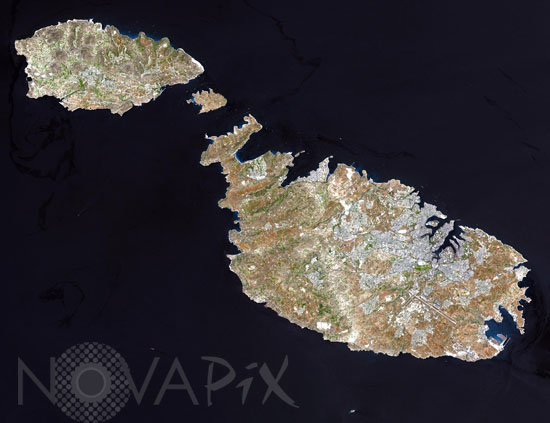
Malta seen from satellite
author: Nasa/GSFC/Novapix
reference: t-eumal-00002
Image Size 300 DPI: 23 * 18 cm
Malta, an independent republic, consists of a small group of islands located in the Mediterranean Sea south of Sicily, with a total area of 316 square kilometers. The capital and leading port of the country is Valletta, which appears as a gray patch around the two deep inlets on Malta's northern coastline. This natural-color image was acquired on July 29, 2001, by the Advanced Spaceborne Thermal Emission and Reflection Radiometer (ASTER) aboard NASA's Terra satellite.
Keywords for this photo:
2001 - ASTER - EARTH - EARTH FROM SPACE - EUROPE - ISLAND - MALTA - MEDITERRANEAN SEA - SATELLITE IMAGE - TERRA -
Contact : Stéphane Aubin +33-(0)9-51-26-53-76
© Novapix - All rights reserved