
Photo Agency - Astronomy - Space - Nature


> Path of hurricane Gustav seen by Envisat satellite
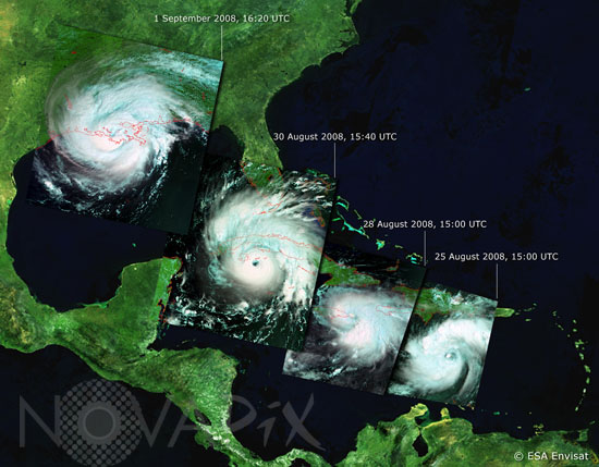
Path of hurricane Gustav seen by Envisat satellite
author: ESA/Novapix
reference: t-nua01-00511
Image Size 300 DPI: 15 * 12 cm
This sequence of Envisat images shows the development and path of Hurricane Gustav on 25 August, 28 August, 30 August and 1 September 2008 (from right to left). Instruments aboard ESA's Envisat allow it to observe various features of hurricanes, including high atmosphere cloud structure and pressure, wind pattern and currents at sea surface level and oceanic warm features that contribute to the intensification of hurricanes.
Keywords for this photo:
2008 - CLOUD - CYCLONE - DEPRESSION - EARTH - EARTH FROM SPACE - ENVISAT - GUSTAV - HURRICANE - METEOROLOGY - SATELLITE IMAGE - STORM - TROPICAL STORM -
Contact : Stéphane Aubin +33-(0)9-51-26-53-76
© Novapix - All rights reserved