
Photo Agency - Astronomy - Space - Nature


> Chesapeake Bay seen from space
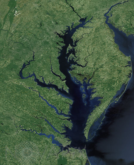
Chesapeake Bay seen from space
author: Nasa/Novapix
reference: t-namld-00002
Image Size 300 DPI: 61 * 75 cm
Chesapeake Bay on the eastern shore of USA seen by Landsat-7 satellite. In 1983 the largest impact crater of the United states of America has been discovered there. With a diameter of 80 km, this 35.5 millions year-old crater is buried more than 300 meters beneath the lower part of the bay.
Contact : Stéphane Aubin +33-(0)9-51-26-53-76
© Novapix - All rights reserved