Photo Agency - Astronomy - Space - Nature

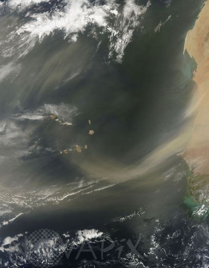
Dust storm over the Cape Verde islands
auteur: Nasa/Novapix
référence: t-afmau-00010
Image Size 300 DPI: 47 * 60 cm
Two dust plumes blow toward the southwest, one plume stretching possibly 150 kilometers (95 miles) off the coast, and the other plume forming an arc that reaches all the way to Cape Verde. Although this image shows dust immediately off the coast of West Africa, a layer of dust from storms such as this often travels virtually intact to the other side of the Atlantic. This layer of dry, hot, dusty air is called the Saharan Air Layer. Terra satellite took this natural-color picture on June 22, 2009. Borders have been added.
Contact : Stéphane Aubin +33-(0)9-51-26-53-76
© Novapix - All rights reserved


