Photo Agency - Astronomy - Space - Nature

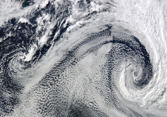
Cyclonic clouds
auteur: Nasa/GSFC/Modis/Novapix
référence: t-nua01-00410
Image Size 300 DPI: 67 * 47 cm
It took the Moderate Resolution Imaging Spectroradiometer (MODIS) on NASAâs Terra satellite a full five minutes to fly over this expansive cloud pattern on April 29, 2009. The sprawling âSâ-shaped swirl is actually two cyclones that seem to be feeding on each other. Polar cyclones often form as a result of low-pressure systems over the ocean, and usually bring winds and heavy snow.
MODIS acquired this photo-like image over the cold waters of the South Atlantic Ocean, where winter is approaching. The image has been rotated, so that north is toward the left. The spot of green in the upper left corner of the image is coastal water off the southern tip of Africa.
Keywords for this photo:
2009 - CLOUD - CYCLONE - EARTH - EARTH FROM SPACE - LOW PRESSURE - METEOROLOGY - MODIS - POSTER - SATELLITE IMAGE - TERRA - WIND -
Contact : Stéphane Aubin +33-(0)9-51-26-53-76
© Novapix - All rights reserved


