Photo Agency - Astronomy - Space - Nature

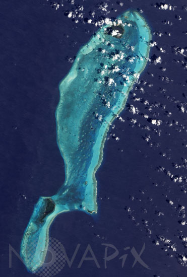
Satellite image of Belizeâs Lighthouse Reef with the Great Blue Hole
auteur: Nasa/Novapix
référence: t-nabel-00001
Image Size 300 DPI: 23 * 34 cm
The Advanced Land Imager (ALI) on NASAâs Earth Observing-1 satellite captured this image of Lighthouse Reef in the Caribbean Sea on March 24, 2009.
In the middle of the image lies a giant circle of deep blue. Roughly 300 meters (1,000 feet) across and 125 meters (400 feet) deep, the feature is known as the Great Blue Hole.
The Great Blue Hole is surrounded by a ring of lighter color caused by elevated coral. In fact, parts of the ring surrounding this feature actually crest the water surface at low tide, but a layer of shallow water covers most of Lighthouse Reef Atoll. Boats leave tiny white tracks on the nearby water surface, and two boats appear to travel away from the Hole in this image. East of the boats, a broad band of aquamarine indicates an area of especially shallow water along the reefâs margin. Along its easternmost edge, the reef crests the ocean surface, where breaking waves from the Caribbean Sea form a jagged line of white. The Great Blue Hole is a vertical cave containing remnants from its days above water. When much of Earthâs water was sequestered in glaciers, global sea level was lower. During this time, stalactites or âdripstonesâ formed inside this cave, and those rocks are preserved underwater today.
Believed to be the worldâs largest feature of its kind, the Great Blue Hole is part of the larger Belize Barrier Reef Reserve System, a World Heritage site of the United Nations Educational, Scientific and Cultural Organization (UNESCO).
Contact : Stéphane Aubin +33-(0)9-51-26-53-76
© Novapix - All rights reserved


