Photo Agency - Astronomy - Space - Nature

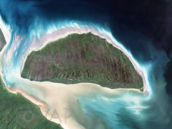
Akimiski Island, Canada, seen by satellite
auteur: Nasa/Novapix
référence: t-nacan-00006
Image Size 300 DPI: 40 * 30 cm
Scraped clean and weighted down for thousands of years by Pleistocene ice sheets, Akimiski Island in James Bay provides a case study of how Earth's land surfaces evolve following glaciation. During the last ice age, this small island was buried under several thousand meters ice, but since its retreat, the island has rebounded (risen in elevation) and new beach areas have emerged, streams and lakes have formed, and trees and other vegetation have colonized the new territory. This image of Akimiski Island was captured by the Landsat 7 satellite on August 9, 2000.
Keywords for this photo:
2000 - AKIMISKI - ARCTIC - CANADA - EARTH - EARTH FROM SPACE - ISLAND - JAMES BAY - LANDSAT - LANDSAT-7 - SATELLITE IMAGE -
Contact : Stéphane Aubin +33-(0)9-51-26-53-76
© Novapix - All rights reserved


