Photo Agency - Astronomy - Space - Nature

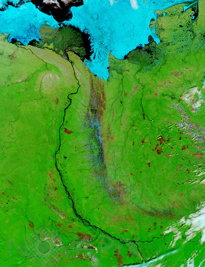
Lena river, Russia, seen by Terra satellite.
auteur: Nasa/GSFC/Novapix
référence: t-asrus-00004
Image Size 300 DPI: 33 * 44 cm
This pair of true- and false-color images from the Moderate Resolution Imaging Spectroradiometer (MODIS)-satellite Terra from June 28, 2002, shows numerous burn scars dotting the northern Siberian landscape along the Lena River. In the true-color image, the burn scars appear dark grayish-brown, while in the false-color image they appear red, as does the bare exposed soil of the Verkhoyansk Mountain Range to the east of the north-flowing Lena. A tinge of blue along the mountains in the false-color image means there is some lingering snow or ice, and that the bare soil is due to springb s late arrival there, and not to burn scars. At the top, sea ice still fills the Laptev Sea.
Keywords for this photo:
2002 - ARCTIC - ASIA - ASTER - EARTH - EARTH FROM SPACE - FALSE COLOR - LAPTEV SEA - LENA - RIVER - RUSSIA - SATELLITE IMAGE - SEA - TERRA - WATER -
Contact : Stéphane Aubin +33-(0)9-51-26-53-76
© Novapix - All rights reserved


