Photo Agency - Astronomy - Space - Nature

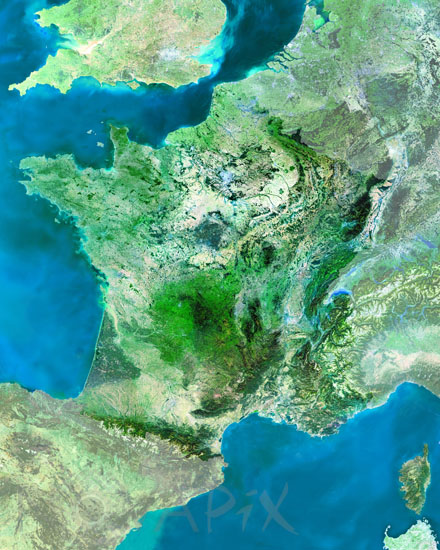
France seen from satellite. 2003
auteur: Esa/Novapix
référence: t-eufra-00003
Image Size 300 DPI: 38 * 48 cm
This MERIS (MEdium Resolution Imaging Spectrometer on the satellite ENVISAT) image centres over France. The country counts about 60 million people, of which more than 10 million live in the area of Paris, its capital. The area of Paris can be seen as a grey splash on the image, towards the center-north of the country, on the Seine's riverbanks. The landscapes are vary between lowlands, hills and mountain chains. The Mont Blanc with the highest peak at 4800 m, near the Italian border is one of the highest points in Europe. France has Belgium, Luxembourg, Germany, Switzerland, Italy, Spain and Andorra as neighbours (from north to south clockwise), and it is only seperated from the UK by 34km by the English Channel.
Keywords for this photo:
2003 - ATLANTIC OCEAN - CHANNEL - EARTH - EARTH FROM SPACE - ENVISAT - EUROPE - FRANCE - MEDITERRANEAN SEA - MERIS - SATELLITE IMAGE -
Contact : Stéphane Aubin +33-(0)9-51-26-53-76
© Novapix - All rights reserved


