Photo Agency - Astronomy - Space - Nature

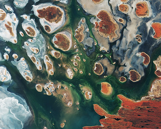
Lake MacKay, Australia
auteur: ESA/Novapix
référence: t-ocaus-00017
Image Size 300 DPI: 34 * 27 cm
Located on the border of the states of Western Australia and Northern Territory, the salt lake only sees water after seasonal rainfall – if at all. It is classified as an ephemeral lake, meaning it exists only after precipitation. This is not the same as a seasonal lake, which sees water for longer periods.
The greens and blues in this image show desert vegetation or algae, soil moisture and minerals – mainly salt. On some of the brown ‘islands’ and on the shore in the lower right, we can see the east–west sand ridges forming lines in the landscape.
The lake lies at the edge of the Great Sandy Desert, which covers nearly 285 000 sq km. This image was captured by the Copernicus Sentinel-2B satellite on 15 March 2017.
Keywords for this photo:
2017 - AUSTRALIA - DESERT - EARTH - EARTH FROM SPACE - GREAT SANDY DESERT - LAKE - SALT LAKE - SATELLITE IMAGE - SENTINEL - SENTINEL-2 -
Contact : Stéphane Aubin +33-(0)9-51-26-53-76
© Novapix - All rights reserved


