Photo Agency - Astronomy - Space - Nature

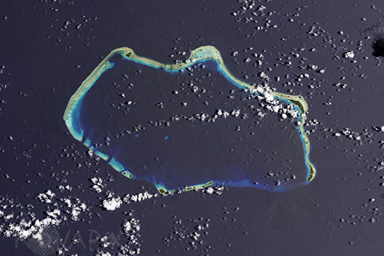
Bikini Atoll seen from space
auteur: Nasa/USGS/Novapix
référence: t-ocmar-00001
Image Size 300 DPI: 35 * 23 cm
This image was captured by the Operational Land Imager on the Landsat 8 satellite on August 19, 2013. Visible top left is the Castle Bravo crater, left behind by the nuclear explosion on March 1, 1954, which was 1,000 times more powerful than the atomic bomb dropped on Hiroshima in August 1945. The hole is 2 kilometers (1.2 miles) across and 80 meters (260 feet) deep.
Contact : Stéphane Aubin +33-(0)9-51-26-53-76
© Novapix - All rights reserved


