Photo Agency - Astronomy - Space - Nature

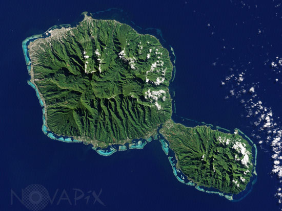
Tahiti seen from space
auteur: Nasa/Novapix
référence: t-octah-00002
Image Size 300 DPI: 18 * 14 cm
The Enhanced Thematic Mapper Plus on the Landsat 7 satellite captured this natural-color image of Tahiti on July 11, 2001. This island is part of a volcanic chain formed by the northwestward movement of the Pacific Plate over a fixed hotspot. Tahiti consists of two old volcanoes—Tahiti-Nui in the northwest and Tahiti-Iti in the southeast—linked by an isthmus.
Contact : Stéphane Aubin +33-(0)9-51-26-53-76
© Novapix - All rights reserved


