Photo Agency - Astronomy - Space - Nature

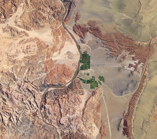
Irrigation along the Orange River
auteur: Nasa/Novapix
référence: t-afsaf-00003
Image Size 300 DPI: 26 * 23 cm
The Orange River serves as part of the border between Namibia and the Republic of South Africa. Along the banks of this river, roughly 100 kilometers (60 miles) inland from where the river empties into the Atlantic Ocean, irrigation projects take advantage of water from the river and soils from the floodplains to grow produce, turning parts of a normally earth-toned landscape emerald green.
The Advanced Land Imager (ALI) on NASA’s Earth Observing-1 (EO-1) satellite captured this true-color image on February 15, 2010. A network of bright rectangles of varying shades of green contrasts with surroundings of gray, beige, tan, and rust.
Keywords for this photo:
2010 - AFRICA - AGRICULTURE - DESERT - EARTH - EARTH FROM SPACE - EO-1 - FIELD - IRRIGATION - NAMIBIA - ORANGE - SATELLITE IMAGE - SOUTH AFRICA -
Contact : Stéphane Aubin +33-(0)9-51-26-53-76
© Novapix - All rights reserved


