Photo Agency - Astronomy - Space - Nature

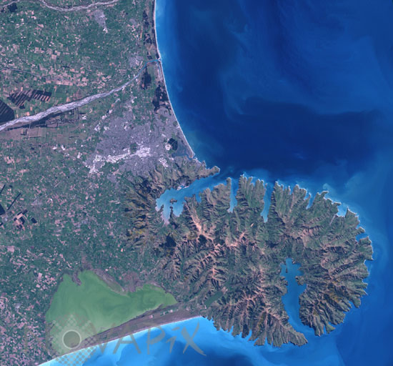
Christchurch and Banks Peninsula (New Zealand)
auteur: Nasa/Novapix
référence: t-ocnze-00005
Image Size 300 DPI: 20 * 19 cm
The Banks Peninsula is formed from the overlapping cones of the extinct Lyttelton and Akaroa volcanoes. Subsequent erosion of the cones formed the heavily dissected terrain visible in the image, and sea level rise led to the creation of several harbors around the Peninsula. Lake Ellesmere is visible at bottom left. Image taken by Landsat-7 satellite on spetember 25, 2001.
Keywords for this photo:
2001 - BANKS - CHRISTCHURCH - CITY - EARTH - EARTH FROM SPACE - EROSION - LANDSAT - LANDSAT-7 - NEW ZEALAND - PENINSULA - SATELLITE IMAGE - VOLCANO -
Contact : Stéphane Aubin +33-(0)9-51-26-53-76
© Novapix - All rights reserved


