
Photo Agency - Astronomy - Space - Nature


> Earth from space gallerie
 |
 |
SlideShow Image 607 / 2740 |  |
 |
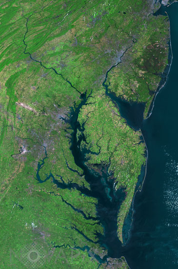
Chesapeake Bay seen from space
auteur: Nasa/USGS/Novapix
référence: t-namld-00004
Image Size 300 DPI: 24 * 36 cm
In 1983 the largest impact crater of the United states of America has been discovered there. With a diameter of 80 km, this 35.5 millions year-old crater is buried more than 300 meters beneath the lower part of the bay. Mosaic of six Landsat 5 images collected in July 2009 and 2011.The Washington D.C.-Baltimore-Philadelphia-New York City corridor can be clearly seen (look for silvery purple) as can the Chesapeake and Delaware Bays and the coastal Atlantic barrier islands from Fishermans Island, Virginia to Sandy Hook, New Jersey.
Contact : Stéphane Aubin +33-(0)9-51-26-53-76
© Novapix - All rights reserved