
Photo Agency - Astronomy - Space - Nature


> Earth from space gallerie
 |
 |
SlideShow Image 395 / 2740 |  |
 |
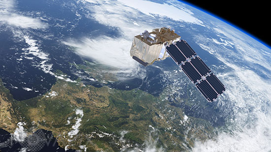
Sentinel-2 satellite - Artist view
auteur: ESA/ATG medialab/Novapix
référence: e-sot01-91104
Image Size 300 DPI: 42 * 23 cm
Sentinel-2 carries a high-resolution multispectral optical imager to monitor changes in vegetation for Europe's environmental monitoring Copernicus programme. This mission offers key information to optimise crop yield, thereby helping to improve food security. Data can be used to measure leaf area index, leaf chlorophyll and leaf water content to monitor plant growth, which is particularly important during the growing season. It will be used to generate land-cover maps, to track changes in the way land is being used and to monitor the worldâs forests. In addition, Sentinel-2 provides information on pollution in lakes and coastal waters. Images of floods, volcanic eruptions and landslides are also offered to help respond to disasters and for humanitarian relief efforts.
Contact : Stéphane Aubin +33-(0)9-51-26-53-76
© Novapix - All rights reserved