
Photo Agency - Astronomy - Space - Nature


> Earth from space gallerie
 |
 |
SlideShow Image 392 / 2740 |  |
 |
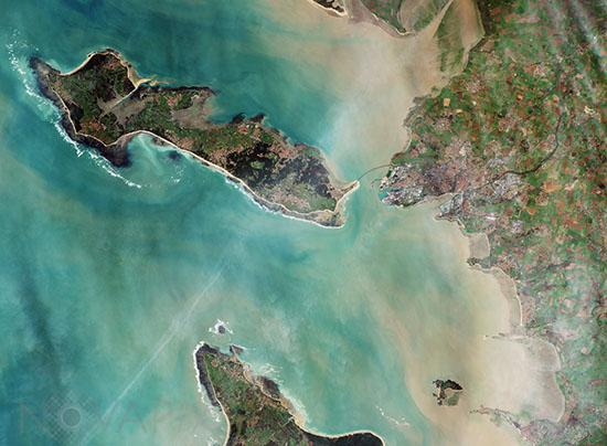
Satellite image of La Rochelle - France
auteur: ESA/Novapix
référence: t-eufra-00057
Image Size 300 DPI: 34 * 25 cm
Capital of the Charente-Maritime department in western France, La Rochelle and surroundings are featured in this Sentinel-2A image, captured on 26 December 2015. Home to some 80 000 people, La Rochelle is a city and a seaport on the Bay of Biscay, a part of the Atlantic Ocean, connected to the Ãle de Ré by a 2.9 km-long bridge, clearly visible in the centre of the image.
Contact : Stéphane Aubin +33-(0)9-51-26-53-76
© Novapix - All rights reserved