
Photo Agency - Astronomy - Space - Nature


> Earth from space gallerie
 |
 |
SlideShow Image 2475 / 2740 |  |
 |
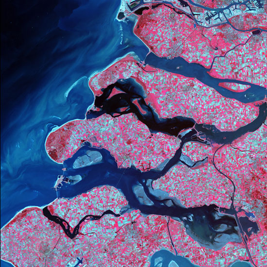
Coast of the Netherlands seen by satellite Terra. 09/2002.
auteur: USGS/Novapix
référence: t-euhol-00001
Image Size 300 DPI: 61 * 61 cm
Along the southern coast of the Netherlands, sediment-laden rivers have created a massive delta of islands and waterways in the gaps between coastal dunes. After unusually severe spring tides devastated this region in 1953, the Dutch built an elaborate system of dikes, canals, dams, bridges, and locks to hold back the North Sea.
Keywords for this photo:
2002 - ASTER - EARTH - EARTH FROM SPACE - EUROPE - NORTH SEA - POSTER - SATELLITE IMAGE - TERRA - THE NETHERLANDS - WATER -
Contact : Stéphane Aubin +33-(0)9-51-26-53-76
© Novapix - All rights reserved