
Photo Agency - Astronomy - Space - Nature


> Earth from space gallerie
 |
 |
SlideShow Image 2470 / 2740 |  |
 |
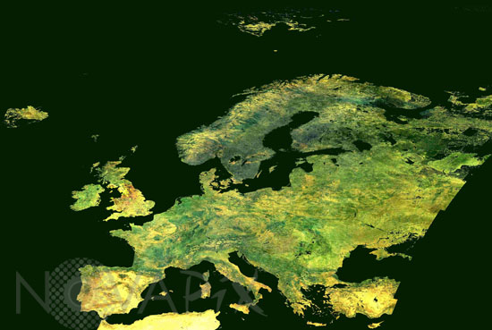
Europe seen from Envisat satellite
auteur: Esa/Novapix
référence: t-europ-00002
Image Size 300 DPI: 25 * 17 cm
The cloud-free face of Europe in the summertime is shown by this mosaic of true-colour land images taken by the Medium Resolution Imaging Spectrometer (MERIS) instrument on board ESA's Envisat environmental satellite. The image is a composite of 85 reduced and full resolution images acquired by MERIS in the summer of 2002, using three out of 15 MERIS spectral bands, taken from Envisat in polar orbit at an altitude of 800 km. By representing the arithmetic average reflectivity, it displays the range of vegetation cover across Europe and North Africa's land surface ââ¬â including the striking green triangle of the Nile Delta, surrounded by arid desert.
Keywords for this photo:
2002 - ATLANTIC OCEAN - BALTIC SEA - EARTH - EARTH FROM SPACE - ENVISAT - EUROPE - MEDITERRANEAN SEA - MERIS - NORTH SEA - SATELLITE IMAGE -
Contact : Stéphane Aubin +33-(0)9-51-26-53-76
© Novapix - All rights reserved