
Photo Agency - Astronomy - Space - Nature


> Earth from space gallerie
 |
 |
SlideShow Image 2436 / 2740 |  |
 |
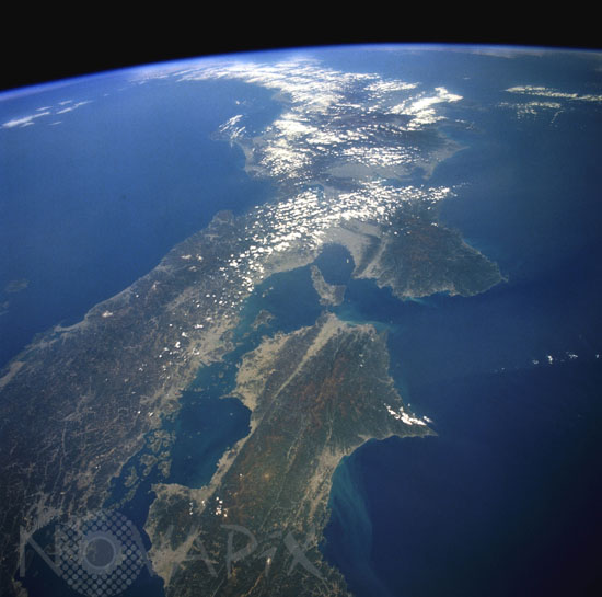
View of the Japanese archipelago.
auteur: Nasa/Novapix
référence: t-asjap-00001
Image Size 300 DPI: 44 * 44 cm
The darker areas show volcanic, mountainous terrain that comprises more than 80 percent of Japan; the lighter, more highly reflective areas of the coastal plains and valleys are urban and agricultural areas. Separated by the Seto Inland Sea are Shikoku Island to the south and the Osaka-Kobe industrial metroplex on Honshu Island to the north. The Sea of Japan lies north of Honshu Island. Several lines, which are northeast-southwest-trending faults, appear on Shikoku Island, extend under the Kii Channel, and continue across southern Honshu Island. This geologically young, earthquake-prone area exists as a result of the collision of the southeast-moving Eurasian Plate and the northwest-moving Philippine Plate. Photo taken from the space shuttle Endeavour in April 1994.
Contact : Stéphane Aubin +33-(0)9-51-26-53-76
© Novapix - All rights reserved