
Photo Agency - Astronomy - Space - Nature


> Earth from space gallerie
 |
 |
SlideShow Image 2409 / 2740 |  |
 |
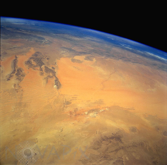
The Grand Erg Occidental, Algeria seen from space. 04/1994
auteur: Nasa/Novapix
référence: t-afalg-00003
Image Size 300 DPI: 33 * 33 cm
The Grand Erg Occidental (sand dune region) of north-central Algeria is the large sandy-looking area in the center of the photograph. This true desert region receives less than 10 inches (25 centimeters) of rainfall per year. The dark features to the southeast are the northwestern edge of the Tademait Plateau. The small dark specks near the southern edge of the photograph are very small oases and a few isolated circular field patterns (center-pivot irrigated fields). Immediately south of the large sand dunes region are several playas (dry lakebeds) where surface deposits of salt produce a highly reflective surface. The darker landforms near the western side of the photograph are slightly elevated bedrock outcrops whose ridge lines average 2000 feet (610 meters) above sea level. Near the horizon, the eastern end of the Atlas Mountains is barely discernible.
Contact : Stéphane Aubin +33-(0)9-51-26-53-76
© Novapix - All rights reserved