
Photo Agency - Astronomy - Space - Nature


> Earth from space gallerie
 |
 |
SlideShow Image 2280 / 2740 |  |
 |
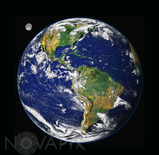
Full view of Earth seen by satellites
auteur: NASA/GSFC/NOAA/ USGS/Novapix
référence: t-glb05-00006
Image Size 300 DPI: 35 * 36 cm
The underlying image of the full disk of Earth and its clouds was taken on September 9, 1997, by a Geostationary Operational Environmental Satellite (GOES). The ocean color data was collected in late September and early October 1997 by NASA's Sea-viewing Wide Field-of-view Sensor (SeaWiFS) satellite. The land color is portrayed by a vegetation index calculated using data collected from September 9-19, 1997, by Advanced Very High Resolution Radiometer (AVHRR) instruments carried aboard NOAA's Polar Orbiting Environmental Satellites (POES).
The prominent storm raging off the west coast of North America is Hurricane Linda. Other obvious features include the shallow waters of the Caribbean and sediments around the mouth of the Amazon River. The presence of the Moon in this image is an artistic addition. The lunar image was collected by GOES in September 1994, and has been magnified to about twice its relative size.
The prominent storm raging off the west coast of North America is Hurricane Linda. Other obvious features include the shallow waters of the Caribbean and sediments around the mouth of the Amazon River. The presence of the Moon in this image is an artistic addition. The lunar image was collected by GOES in September 1994, and has been magnified to about twice its relative size.
Contact : Stéphane Aubin +33-(0)9-51-26-53-76
© Novapix - All rights reserved