
Photo Agency - Astronomy - Space - Nature


> Earth from space gallerie
 |
 |
SlideShow Image 2278 / 2740 |  |
 |
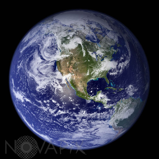
Earth seen by satellite
auteur: Nasa/USGS/DMSP/Novapix
référence: t-glb05-00009
Image Size 300 DPI: 17 * 17 cm
Much of the information contained in this image came from a single remote-sensing device-NASA's Moderate Resolution Imaging Spectroradiometer, or MODIS. Flying over 700 km above the Earth onboard the Terra satellite, MODIS provides an integrated tool for observing a variety of terrestrial, oceanic, and atmospheric features of the Earth. The land and coastal ocean portions of these images are based on surface observations collected from June through September 2001 and combined, or composited, every eight days to compensate for clouds that might block the sensor's view of the surface on any single day. MODIS observations of polar sea ice were combined with observations of Antarctica made by the National Oceanic and Atmospheric Administration's AVHRR sensor"the Advanced Very High Resolution Radiometer. The cloud image is a composite of two days of imagery collected in visible light wavelengths and a third day of thermal infra-red imagery over the poles.
Keywords for this photo:
2001 - CLOUD - EARTH - EARTH FROM SPACE - GLOBAL VIEW - METEOROLOGY - MODIS - PLANET - SATELLITE IMAGE - TERRA -
Contact : Stéphane Aubin +33-(0)9-51-26-53-76
© Novapix - All rights reserved