
Photo Agency - Astronomy - Space - Nature


> Earth from space gallerie
 |
 |
SlideShow Image 2277 / 2740 |  |
 |
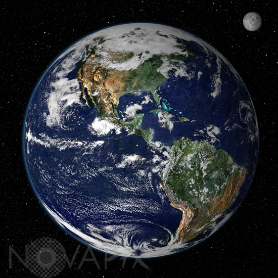
Earth seen by satellite
auteur: NASA/GSFC/NOAA/Novapix
référence: t-glb05-00010
Image Size 300 DPI: 34 * 34 cm
This true-color image shows North and South America as they would appear from space 35,000 km (22,000 miles) above the Earth. The image is a combination of data from two satellites. The Moderate Resolution Imaging Spectroradiometer (MODIS) instrument aboard NASA's Terra satellite collected the land surface data over 16 days, while NOAA's Geostationary Operational Environmental Satellite (GOES) produced a snapshot of the Earth's clouds
Keywords for this photo:
CLOUD - EARTH - EARTH FROM SPACE - GLOBAL VIEW - GOES - METEOROLOGY - MODIS - MOON - PLANET - SATELLITE - SATELLITE IMAGE - TERRA -
Contact : Stéphane Aubin +33-(0)9-51-26-53-76
© Novapix - All rights reserved