
Photo Agency - Astronomy - Space - Nature


> Earth from space gallerie
 |
 |
SlideShow Image 2269 / 2740 |  |
 |
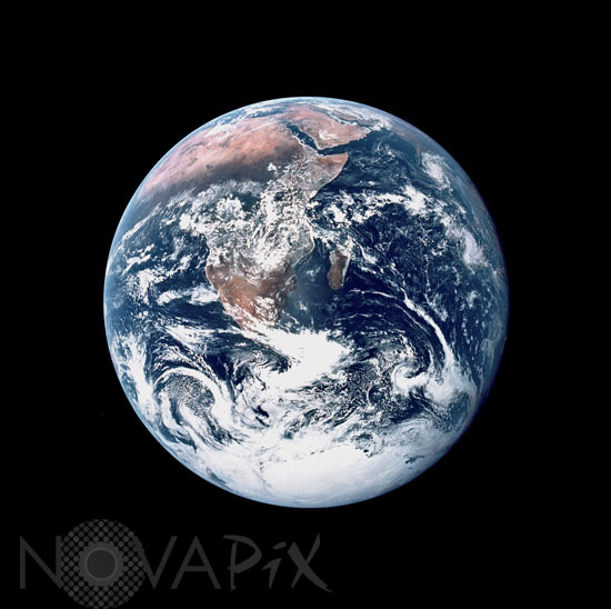
View of the Earth seen by Apollo 17
auteur: Nasa/Novapix
référence: t-glb09-00050
Image Size 300 DPI: 25 * 25 cm
View of the Earth as seen by the Apollo 17 crew traveling toward the moon. This translunar coast photograph extends from the Meditierranean Sea area to the Antarctica south polar ice cap. This is the first time the Apollo trajectory made it possible to photograph the south polar ice cap. Note the heavy cloud cover in the southern hemisphere. Almost the entire coastline of Africa is clearly visible. The Arabian Peninsula can be seen at the northeastern edge of Africa. The large island off the coast of Africa is the Malagasy Republic. The Asian mainland is on the horizon toward the northeast.
Keywords for this photo:
1972 - AFRICA - ANTARCTICA - APOLLO - APOLLO 17 - CLOUD - EARTH - EARTH FROM SPACE - GLOBAL VIEW - PLANET - SOUTH POLE -
Contact : Stéphane Aubin +33-(0)9-51-26-53-76
© Novapix - All rights reserved