
Photo Agency - Astronomy - Space - Nature


> Earth from space gallerie
 |
 |
SlideShow Image 2150 / 2740 |  |
 |
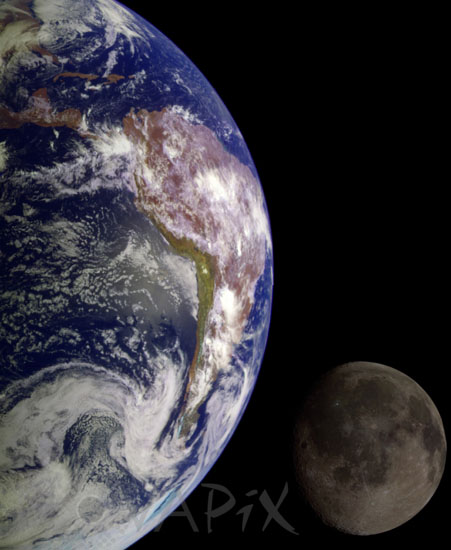
The Earth and Moon seen by Galileo
auteur: USGS/Novapix
référence: a-lun50-00005
Image Size 300 DPI: 14 * 17 cm
Separate images of the Earth and Moon were combined to generate this view. The Galileo spacecraft took the images in 1992 on its way to explore the Jupiter system in 1995-97. The image shows a partial view of the Earth centered on the Pacific Ocean about latitude 20 degrees south. The west coast of South America can be observed as well as the Caribbean. The distinct bright ray crater at the bottom of the Moon is the Tycho impact basin. This picture contains same scale and relative color/albedo images of the Earth and Moon.
Keywords for this photo:
1992 - ALBEDO - COMPARISON - COMPOSITE - EARTH - EARTH FROM SPACE - GALILEO - MOON - PLANET - SATELLITE - SPACE -
Contact : Stéphane Aubin +33-(0)9-51-26-53-76
© Novapix - All rights reserved