
Photo Agency - Astronomy - Space - Nature


> Earth from space gallerie
 |
 |
SlideShow Image 1661 / 2740 |  |
 |
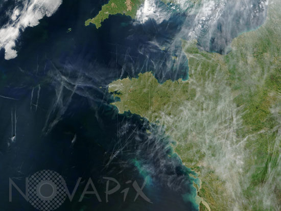
Airplane contrails over Brittany, France
auteur: Nasa/GSFC/Novapix
référence: t-eufra-00020
Image Size 300 DPI: 27 * 20 cm
This true-color Moderate Resolution Imaging Spectroradiometer (MODIS) image, acquired on April 25, 2004 by the Terra satellite, shows a web of contrails over northwestern Europe. These contrails are straight lines of ice crystals that form in the wake of jet liners where air temperatures at altitude are lower than about 40°C. Newer contrails are thin whereas older trails have widened with time as a result of light winds. The problem with contrails is that they can spread into extensive high, thin cirrus clouds, which tend to warm the Earth because they reflect less sunlight back to space than the amount of heat they trap.
Contact : Stéphane Aubin +33-(0)9-51-26-53-76
© Novapix - All rights reserved