
Photo Agency - Astronomy - Space - Nature


> Earth from space gallerie
 |
 |
SlideShow Image 1637 / 2740 |  |
 |
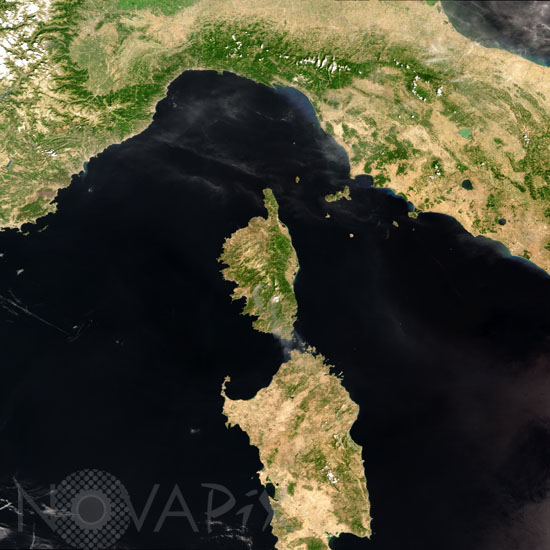
Corsica and Sardinia seen by satellite Envisat
auteur: ESA/Novapix
référence: t-eufra-00021
Image Size 300 DPI: 19 * 19 cm
This Medium Resolution Imaging Spectrometer (MERIS) image was acquired on 10 August 2003 over the central part of the Mediterranean Sea, and shows the central north-western coast of the Italian peninsula and the islands of Corsica (France) and Sardinia. Over the Island of Corsica, at middle south area, smoke from two burning fires is visible.
Keywords for this photo:
2003 - CORSICA - EARTH - EARTH FROM SPACE - ELBA - ENVISAT - EUROPE - FIRE - FRANCE - ISLAND - ITALY - MEDITERRANEAN SEA - MERIS - SARDINIA - SATELLITE IMAGE - SMOKE -
Contact : Stéphane Aubin +33-(0)9-51-26-53-76
© Novapix - All rights reserved